The exploration of outer space and
launching of satellites started in the 1960s. Having some romantic flair
in the beginning, the satellite story went on and nowadays satellites
are launched often and almost everywhere around the globe and their
number is going to grow in the future. Together with that, a new
question arose, what to do with a bunch of new information received? A
huge lot of information has been gained in the satellite era, but its
practical appliance can be seen only in certain spheres of economics.
One of the spheres where data received from satellites are used
effectively is agriculture. There is a range of agricultural problems
which can be solved with the help of these data. Satellites are
classified into ones of high resolution, of medium and of small.
Basically for agriculture satellites of medium resolution of 5–250m per
pixel are used. What can be seen in such satellite images and what tasks
can be done with the help of satellite data?
Using
satellite data one can judge about the level of cultivation of
soil in specified area, identify actively cultivated and abandoned
fields and define their configuration. Also with the help of satellite
data it’s possible to get information about the current state of things
without visiting a specific field. Analysis of satellite data allows
understanding whether agricultural events are properly conducted,
whether the technologies of cultivation are not violated, and whether
soil requires additional treatment for enhancing fertility. With
satellite images it’s possible to evaluate condition of agricultural
plants; the normalized difference vegetation index (
NDVI)
is designed for that. The normalized difference vegetation index is a
simple graphical indicator of biomass active photosynthetically that is
calculated via several spectral channels. Satellite possesses from 10 to
30 spectral channels. Any satellite has its own set of channels which
can be visible, infrared, ultraviolet, thermal, etc. Satellites measure
the reflectance of the planet in many spectral resolutions as Earth
looks different in various spectral resolutions. Plants reflect light
well in one spectrum while plants do absorb it in another spectrum.
Correlation of these indicators allows defining live green plants from
other objects. The
NDVI is
one of the most well-known and used index to detect live green plant
canopies and to evaluate vegetated areas, their condition and quality.
Let’s see what tasks can be performed with the NDVI.
Monitoring of crop emergence.
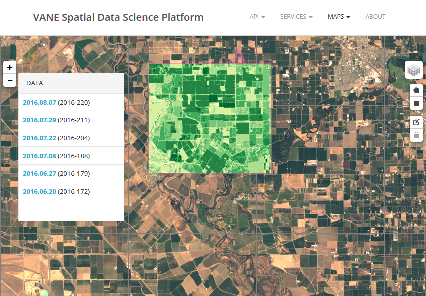
Real-time monitoring allows supervising the current situation and forecasting crop yields. Using the NDVI it is possible to detect presence of plants, its dynamics of emergence and growth. Maps of the NDVI with
dynamics (various seasons) let tracing peculiar features of seasonal
vegetation, its deviations, allow planning, etc. For instance, knowing
weather forecast, condition of plants and considering the current date,
forecast about the amount of yield in the current year can be made.
However, a specific feature of satellite monitoring should be taken in
to consideration: satellite technology works for global tasks only, this
technology is pointless for small farms. Small local farms do not need
satellite technologies in their everyday operations. But this kind of
information can be of great importance for wholesale purchasing
companies. In this case information about extensive regions is of big
interest: what region is more fertile, what plants grow widely and where
wholesale can be done.
 |
| Field of green onion. Colombia, Aquitania |
Analysis of historical data.
Historical data
is information on the cultivation of fields, evaluation of their
productivity and the efficiency of the technologies used. Currently a
large archive on a daily survey of earth surface is gained. For example,
satellites of MODIS system orbit earth on a daily basis since 2000.
In
this archive history on any field cultivation for the last 15 years can
be obtained. This is a great opportunity for insurance companies to
receive information about a future customer and to decrease potential
risks.
 |
| NDVI maps |
Evaluation of efficiency of water reclamation systems.
Condition
of irrigation and drainage systems, their violation and failures can be
estimated by comparative productivity of specific kinds of agricultural
plants.
Evaluation of pastures and hunting grounds.
The
NDVI allows effectively and at a low cost solving such tasks as
assessment of quality of hunting grounds and of pasture productivity for
planning of their usage and detecting violations of cattle grazing.